
價格:免費
更新日期:2019-05-24
檔案大小:14.3 MB
目前版本:2.0.0
版本需求:需要 iOS 10.3 或以上版本。與 iPad 相容。
支援語言:英語

Cold Weather Altitude Correction is a tool for visualizing and calculating approaches at low temperatures.
Conventional tools are calculating only a list of temperature corrected altitudes. This tool is designed more closely to a real approach. Corrected altitudes are presented in a graphical interface. A table of distances with related corrected altitudes can be calculated.

The calculation s based on ICAO PANS OPS Doc 8168.
It uses a more accurate method as the well-known 4 per correction, which becomes imprecise for temperatures below -15°C.
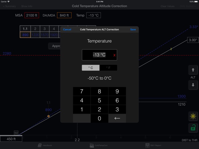
With only field elevation and temperature a graphic layout will be shown:
- glide path down to the runway

- corrected MSA
- corrected MDA
- corrected GPA
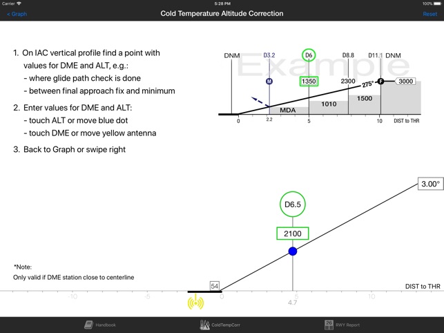
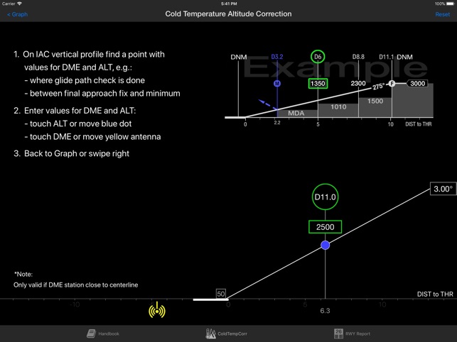
Moving a yellow dot along the glide path down to the runway will show any corrected altitudes with their related distances to threshold or to a DME station.

Distance - Altitude Table:
A table with distance and corrected altitude can be calculated. This table is similar to the distance / altitude tables known from instrument approach charts, but it will show corrected altitudes.
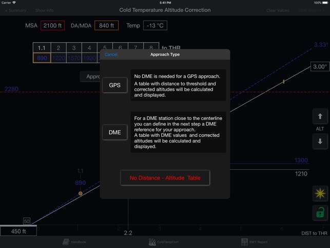
You can choose between an approach type based on "distance to threshold" or based on a defined DME station.
A handbook is included in the app itself.
For night operations you can switch to dark mode.
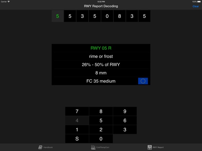
In addition you will find a decoder for METAR RWY Reports.
支援平台:iPad